

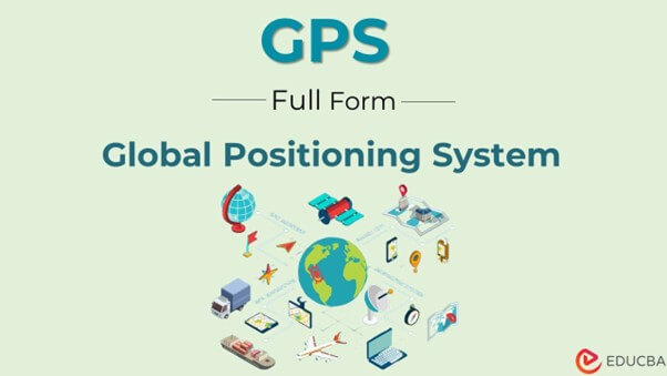
What is the Full Form of GPS?
The full form of GPS is the “Global Positioning System.” GPS has transformed the way you navigate the world. From finding the quickest route to a new destination to tracking wildlife and shipping containers, GPS has become an indispensable tool across many industries.
But what exactly is GPS, and how does it work? This blog explores GPS, its history, how it works, and its many applications. You will also look at the advantages and disadvantages of GPS and what the future holds for this groundbreaking technology.
Table of Contents
- Full Form of GPS
- What is GPS?
- History of GPS
- Components of GPS
- How Does GPS Work?
- Applications of GPS
- Advantages of GPS
- Disadvantages of GPS
- GPS vs. GNSS
- Factors Affecting
- Future of GPS Technology
What is GPS?
GPS is a satellite-based navigation system that uses signals from a constellation of at least 24 satellites orbiting Earth. These satellites transmit signals that GPS receivers on the ground pick up and use to calculate the receiver’s precise location.
History of GPS
The United States developed GPS primarily for military navigation and positioning. The system became operational in 1995, following years of satellite launches, testing, and development. Over time, GPS expanded into civilian applications, supporting everyday navigation, transportation, surveying, agriculture, and telecommunications.
Components of GPS
GPS consists of three main segments that work together to provide positioning, navigation, and timing information.
- Space Segment: Includes GPS satellites orbiting Earth that transmit signals containing their position and timing information.
- Control Segment: Consists of ground stations that monitor satellites, track their orbits, and update navigation data.
- User Segment: Includes GPS receivers in smartphones, vehicles, watches, surveying equipment, and other devices that process satellite signals to calculate positions.
How Does GPS Work?
A GPS receiver calculates its location by determining the distance to at least four GPS satellites. The receiver uses the time it takes the signals to reach it, along with the satellites’ precise locations, to triangulate its position. The GPS receiver needs precise time to determine its location. The GPS satellites include atomic clocks, which allow them to transmit highly accurate time signals.
By comparing transmission and reception times, the GPS receiver can determine the distance to the satellites. The GPS receiver then uses this information to calculate its position, accounting for the satellites’ positions and any atmospheric or other interference that might affect the signal. The result is a highly accurate determination of the receiver’s location, often within a few meters.
Applications of GPS
Now that you understand what GPS is and how it works, let’s look at its wide range of applications. GPS has become an essential technology in many industries because it provides accurate location and timing information. From helping people find directions to supporting farming, transportation, and scientific research, GPS offers several practical applications.
1. Navigation
People use GPS widely for navigation in vehicles and on foot. GPS-enabled devices, such as smartphones and dedicated GPS receivers, provide turn-by-turn directions and real-time updates on traffic and other conditions. Navigation apps such as Google Maps use GPS data to identify a user’s current location, calculate routes, and provide turn-by-turn directions. Drivers can also use GPS to find alternative routes, locate nearby services, and estimate arrival times. Similarly, hikers, cyclists, pilots, and sailors rely on GPS devices to navigate unfamiliar areas.
2. Geolocation
GPS can determine a person’s or object’s precise location. This is useful for applications such as tracking wildlife, finding lost hikers, and monitoring delivery truck movements. Businesses use GPS tracking systems to monitor delivery vehicles, manage fleets, and track shipments during transportation. Wildlife researchers use GPS collars and tracking devices to study animal movements, migration patterns, and habitats. GPS-enabled emergency services can also use location information to help locate people in distress.
3. Surveying and Land Measurement
Surveying and mapping commonly use GPS, allowing surveyors to determine the precise location of points on the ground. High-precision GPS methods help professionals measure land boundaries, establish construction reference points, and collect geographic data. Surveying teams can also use GPS to monitor changes in land elevation and infrastructure over time. These measurements support road construction, property mapping, urban planning, and engineering projects.
4. Agriculture
GPS can precisely map fields, assist with planting and harvesting, and monitor crop health. GPS-enabled equipment can guide tractors, seeders, and harvesters along planned routes, reducing overlapping passes and saving fuel. Farmers can use GPS data to map field boundaries, apply fertilizers and pesticides more accurately, and monitor crop conditions across different areas. These applications can improve resource management, reduce waste, and support better crop productivity.
5. Weather Forecasting
GPS signals can gather data on atmospheric conditions, such as temperature and pressure, which weather forecasting models then use. Scientists analyze how GPS signals change as they pass through the atmosphere to estimate water vapor levels. Meteorologists use this information to improve weather models and monitor atmospheric moisture, helping predict rainfall and severe weather. GPS data also supports research into atmospheric processes and climate patterns.
6. Mapping and Geographic Information Systems
GPS creates detailed maps and geospatial information products. Geographic Information Systems (GIS) combine GPS coordinates with other geographic information to analyze roads, buildings, land use, water resources, and environmental features. Governments use these maps for urban planning, infrastructure development, and disaster management. Businesses can also use GPS-based mapping to identify suitable locations, plan delivery routes, and understand customer distribution.
7. Timing and Synchronization
GPS provides highly accurate time signals, which are crucial for applications such as financial transactions, power grid management, and scientific research. Telecommunications networks use GPS timing to coordinate data transmission between network components. Power grid operators rely on synchronized clocks to monitor electricity networks and identify disturbances. Financial institutions, scientific laboratories, and data centers also use precise timing to coordinate operations, record events, and maintain accurate timestamps.
8. Emergency and Disaster Management
GPS helps emergency responders identify locations and coordinate rescue operations during accidents, natural disasters, and other emergencies. Search-and-rescue teams use GPS devices to navigate difficult terrain and record the areas they search. Authorities can also combine GPS coordinates with digital maps to identify affected areas, plan evacuation routes, and direct emergency resources. In remote locations, GPS-enabled tracking devices can help rescuers locate people who need assistance.
9. Aviation and Marine Transportation
Pilots and ship operators use GPS to determine their positions, follow planned routes, and navigate across long distances. In aviation, GPS supports area navigation, approach procedures, and route planning when used with approved systems and procedures. Ships use GPS for route monitoring, position reporting, and navigation at sea. These applications improve situational awareness, although operators must also follow applicable safety procedures and use backup navigation methods when necessary.
10. Sports and Fitness Tracking
GPS is widely used in fitness watches, smartphones, and sports tracking devices. Runners and cyclists use GPS to measure distance, speed, pace, and routes during outdoor activities. Coaches and athletes can analyze this information to evaluate performance and plan training sessions. GPS also supports hiking and outdoor recreation by recording routes and helping users navigate trails.
11. Construction and Infrastructure Development
Construction companies use GPS to position machinery, survey project sites, and monitor construction progress. GPS-enabled equipment can follow digital design plans when performing tasks such as grading land, excavating, and preparing road surfaces. Project teams can also record the locations of underground utilities and other infrastructure assets. High-precision GPS equipment improves positioning accuracy and reduces measurement errors in suitable working conditions.
12. Military and Defense
GPS supports military operations by providing positioning, navigation, and timing information. Armed forces use it to navigate vehicles and aircraft, coordinate movements, and synchronize communication and operational systems. GPS also supports logistics by helping track equipment and supplies. However, GPS signals can be subject to interference or deliberate disruption, so military systems may use additional navigation technologies to maintain operational reliability.
Advantages of GPS
GPS offers numerous benefits, including:
1. Precision and Accuracy
GPS’s most significant advantages are its precision and accuracy. GPS uses signals from a network of satellites to determine a device’s location, and these calculations can be accurate to within a few meters. This accuracy makes GPS ideal for surveying, navigation, and tracking.
2. Real-Time Information
GPS provides real-time information, which is crucial for many applications. For example, real-time data can support navigation by providing up-to-date traffic and route information. This helps drivers avoid congested roads and reach their destination faster.
3. Wide Availability
GPS is available worldwide, making it a valuable tool for navigation and location determination. This global availability has led to widespread adoption of GPS for applications ranging from navigation and surveying to wildlife tracking and search-and-rescue operations.
4. Cost-Effective
GPS technology was relatively expensive in the past, making it inaccessible to many users. However, GPS device costs have dropped significantly due to technological advances and increased competition. In recent years, GPS has become more accessible and cost-effective.
Disadvantages of GPS
Despite its many benefits, GPS has some limitations that can affect its accuracy, reliability, and usability in certain situations.
1. Limited Availability
While GPS signals are widely available, buildings, trees, and other obstructions can disrupt them, limiting availability in some locations. GPS signals may also weaken indoors, underground, or in areas surrounded by tall buildings. These conditions can make it difficult for receivers to determine an accurate location.
2. Cost
While GPS receiver prices have decreased significantly in recent years, high-end GPS systems can still be expensive, making them less accessible to some users. Advanced GPS equipment used for surveying, aviation, and military applications often requires specialized hardware and software. Users may also incur additional costs for installation, maintenance, and subscription-based tracking services.
3. Dependence on Satellites
GPS relies on a network of satellites to provide location and time information, making it vulnerable to disruption if satellite signals become unavailable. Signal interference, jamming, or spoofing can affect GPS accuracy and reliability. Therefore, critical operations may require backup navigation systems to maintain continuity when GPS signals are disrupted.
4. Limited Battery Life
GPS receivers can consume a lot of power, limiting their battery life. This is especially problematic for GPS devices used for extended periods, such as during outdoor activities like hiking or camping. Continuous location tracking and frequent position updates can drain smartphone and smartwatch batteries more quickly. Users may need to carry portable chargers or reduce tracking frequency to extend battery life.
GPS vs. GNSS
GPS is a satellite navigation system, while GNSS is the broader category of global satellite navigation systems.
| Feature | GPS | GNSS |
| Full Form | Global Positioning System | Global Navigation Satellite System |
| Coverage | Global | Global, depending on the systems used |
| Ownership | United States | Includes systems operated by different countries and regions |
| Examples | American GPS satellites | GPS, GLONASS, Galileo, and BeiDou |
| Main Purpose | Positioning, navigation, and timing | Positioning, navigation, and timing |
Many modern devices support multiple GNSS constellations, which can improve satellite availability and positioning performance in suitable conditions.
Factors Affecting GPS Accuracy
GPS accuracy depends on several environmental and technical factors. Buildings, dense tree cover, tunnels, and mountains can obstruct satellite signals. Atmospheric conditions, signal reflections from nearby surfaces, interference, and receiver quality can also affect positioning accuracy. High-precision equipment and correction services can improve accuracy for specialized applications such as land surveying and construction.
Future of GPS Technology
GPS technology is expected to become more accurate and dependable as satellite networks, positioning methods, and connected devices continue to advance. Modern GPS technology is expected to support more precise navigation, autonomous vehicles, smart cities, and emergency response systems. These developments can help industries operate more efficiently and improve everyday convenience.
- Improved Positioning Accuracy: Advances in satellite signals, GPS receivers, and correction technologies can provide more precise location information for applications such as surveying, construction, and navigation.
- Autonomous Vehicles: Self-driving cars and delivery robots can combine GPS data with cameras, radar, and other sensors to determine their positions and navigate routes. Reliable positioning is especially important for safe and efficient transportation.
- Smart Cities: GPS can help cities manage public transportation, monitor vehicle movements, optimize delivery routes, and improve traffic management. Combining GPS data with other smart technologies can support better urban planning.
- Emergency Response Systems: GPS-enabled devices can help emergency services locate people in distress, coordinate rescue teams, and identify suitable routes during accidents and natural disasters.
- Integration with Advanced Technologies: Combining GPS with artificial intelligence, the Internet of Things, and other navigation systems can improve location-based services, asset tracking, and real-time decision-making.
Although GPS technology continues to evolve, challenges such as signal interference, indoor positioning limitations, and cybersecurity risks remain. Continued improvements in satellite infrastructure and complementary positioning technologies will help make GPS more reliable for future applications.
Final Thoughts
GPS has transformed navigation and location tracking by providing accurate, real-time information across industries. Understanding the Full Form of GPS, its applications, advantages, and limitations helps users make better use of this technology. Although GPS depends on satellite signals and can drain device batteries, ongoing technological advancements continue to expand its role in everyday life.
Frequently Asked Questions (FAQs)
Q1. What is the full form of GPS?
Answer: GPS stands for Global Positioning System. It is a satellite-based system that provides positioning, navigation, and timing information.
Q2. Does GPS require an internet connection?
Answer: No, GPS receivers can calculate a position using satellite signals without an internet connection. However, you may need internet access for live traffic updates, online maps, and other connected services.
Q3. How many satellites does GPS use?
Answer: GPS is designed to maintain a constellation of at least 24 operational satellites, though more may be available at any given time.
Q4. How accurate is GPS?
Answer: Under favorable conditions, GPS-enabled devices can often determine their location within several meters. Accuracy varies with the receiver, surroundings, satellite geometry, and whether correction technologies are used.
Q5. What is the difference between GPS and GNSS?
Answer: GPS is the satellite navigation system operated by the United States. GNSS is the general term for satellite navigation systems, including GPS, GLONASS, Galileo, and BeiDou.
Recommended Articles
We hope this comprehensive guide to the full form of GPS helps you understand its technology, applications, and benefits. Check out these recommended articles for more insights into GPS and its role in navigation and everyday life.