Updated April 9, 2023
Introduction to Raster Data
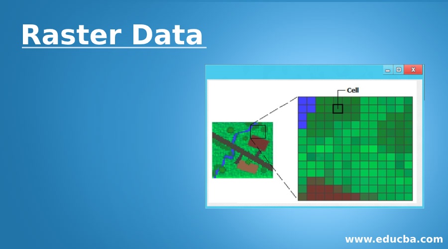
Raster Data is the type of geospatial data that is used to geocode maps and fill in the information related to surface features. It can be a pixel, matrix or even collection of cell forming a picture in general term. The Satellite imagery and the layers are classified into Raster Data. Unlike Vector Data, this form of data represents the interior part of the feature. Vector Data forms the boundary of any geo feature, and Raster Data fills the feature with specific pixelation. Raster Data are more into storing temperature, elevation, depth and soil pH value related data. The colour contrast varies from. Location to location and also depends on various geographical features covering the area. Two types of Raster data are Discrete Raster Data and Continuous Raster Data.
Source Link: https://desktop.arcgis.com/en/arcmap/10.3/manage-data/raster-and-images/what-is-raster-data.htm
How does Raster Data Work?
- As given in the above definition, each cell or the matrix act as a data container. They can be called the variables that store colour-specific information depending on the classification and nature of the geographic feature. In the Raster form of data, the map area is divided into several cells and a matrix. The area is equally distributed with the help of Rows and Columns. Each cell of the row and the column has some unique attributes that define the value.
- Most of the raster data pixels are in a square or rectangular format, but other shapes like triangular or hexagonal are also possible. The whole imagery or datasheet contains all these uniquely filled cells and forms the Raster data. Raster spatial data structures are two-dimensional arrays; this means that the area that each cell grid represents can both be used to define map resolution and the number of cell grids to describe the spatial distribution. Single-pixel or a cell in the layer can only have one attribute being mapped to it. To handle more than one attribute, more data layers need to be created. These layers can be visualized as stacked, one on top of the other.
- While working on any project, GIS Analysts and Technicians load the Raster data models from the serving source and then work on the geocoding and referencing part. Based on the Raster data’s reference, they further create the vector map objects that consist of point, line, and polygon. The data is stored in various file formats like Images (.IMG, .JPG, and . PNG file extensions), ESRI uses bit maps (.BMP, .BPW) and many more customized formats.
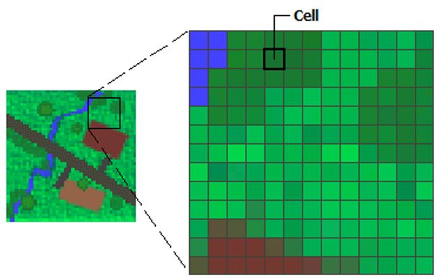
- The Raster Data is the imagery form of the surface area where each pixel in the data describes the surface area.Camera Sensors are used to capture the features with the help of electromagnetic waves generated through the sensors. The data collected from these sensors are the measurements that are reflected using electromagnetic waves.
- There are primarily two types of sensors, Active Sensors and Passive Sensors.Passive Sensorsin the satellite sensors that detect only the data emitted from the landscape or reflected from any other light source. Active Sensors emits their signal, and the sensors in the satellite measures what is reflected. SONAR and RADAR are perfect examples of this type of sensor.
Passive Sensor Active Sensor
Source Link: https://www.sciencedirect.com/topics/earth-and-planetary-sciences/raster
Types of Raster Data
Raster Data is further classified into various types; they are:
- Satellite Imagery
- Digital Elevation Model(DEM)
- Digital Orthophotos
- Binary Scanned Files
- Graphic Files
Let us study the above-mentioned types in details:
1. Satellite Imagery
The imagery is remotely sensed and collected data in the raster format. The image value in the pixel represents the light or energy that is emitted and reflected from the earth back to the satellite sensors, which collects the data. Various types of land use and hydrography features can be classified during image processing. The imagery generated through this method can be either in RGB format or in traditional black & white format.
2. Digital Elevation Model (DEM)
Digital Elevation Model is the computer graphic representation of any terrain surface. This can be of a Mountain, Plateau or even a Planet. The models that are generated with the help of the Digital Elevation Model technique are mainly 2 dimensional and 3-dimensional array of data. The information equipped in Digital Elevation Model is by using remote sensing techniques like photogrammetry (a type of collecting images of physical objects), LIDAR (With the help of laser technique), IfSAR (a type of RADAR technique) and land surveying (With the help of field workers). The data collected in the Digital Elevation Model can be point-based, but it can be converted into the raster format.
DEM of Snow covered mountains
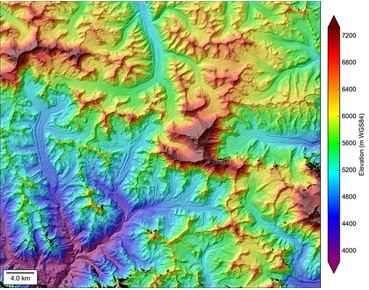
Source Link: https://nsidc.org/data/highmountainasia
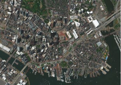
3. Digital Orthophotos
Digital Orthophoto is a type of aerial imagery or satellite imagery that is extracted using remote sensing techniques. It is said to the corrected and processed imagery where the camera tilts and terrain relief is removed. This imagery form is geometrically correct and used for the digitization of 2D models. The collection of these Orthophotos form a large sheet of imagery, also known as Google Earth imagery is the perfect example of this orthophoto.
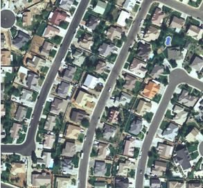
Source Link: http://aerialmappingphotography.blogspot.com/2012/01/advantages-of-digital-orthophotography.html
4. Binary Scanned Files
As the name states, the data in these type of files are stored in binary format (value of 0 and 1). These type of image files are mostly monochromatic, i.e. they are only available in black and white. The images, in general terms, are also known as grayscale images. Due to less utilization of pixels of different values, the data and the file are easy to handle because of their low bit and byte size.
Binary Images Showing the presence in black, grey and white
5. Graphic Files
In this format, the Maps, Photographs and Images can be stored as digital graphic files. The popular graphic files that we come across in our daily life are GIF (Graphic Interchange Format), TIFF (Tagged Image File Format), JPEG (Joint Photographic Experts Group) and PNG (Portable Network Graphics)
Advantages of Raster Data
Below are the advantages mentioned:
- Raster Datais the simplest form of data structures, and hence they are easy to use and understand by the Geographic Information Systems Workforce.
- This data form can be used to do various spatial analysis.
- The model maintains uniformity when it comes to size and shape due to matrix and multi-array like structure.
- Comparatively to its vector counterpart, the technology is far cheaper and affordable.
- This makes the data livelier and presentable due to the involvement of colour codes, and hence when pairing with vector models, it gives proper relatable information.
Conclusion
With the help of Raster data form, spatial data becomes valuable. Most of the organization that is into GIS domain refer to external raster data forms. Raster data is simple yet heavy to handle due to toa large amount of imagery related files. Unlike earlier days, RDMS and Systems have become robust to handle these large and heavy data models. Both the data types are crucial in the world of GIS, but Raster data is the most preferred one.
Recommended Articles
This is a guide to Raster Data. Here we discuss Introduction to Raster Data along with the working and 5 different types and the advantages. You can also go through our other related articles to learn more –